KEVIN Z
Documented research inventory
Macro
Destruction, Piles, Mounds
The ancient town of Sebastia northwest of Nablus in the West Bank remains a target of continuous attacks by the Israeli army and settlers. Over 60 per cent of the West Bank is classified as Over 60 percent of the West Bank is classified as Area C, under Israeli security and administrative control. Palestinian construction is prohibited by Israel in 70 per cent of Area C and heavily restricted in a further 29 per cent. Only 13 percent of East Jerusalem is zoned by Israel for construction by Palestinians, most of which is already built up. Thirty-five percent of East Jerusalem has been allocated for settlement use. The demolition of Palestinian residential and livelihood structures is the most direct trigger of forced displacement in the West Bank, including East Jerusalem. Such demolitions have a grave humanitarian impact on the lives and livelihoods of those affected. Demolitions often impact the most vulnerable Palestinians, already less able to cope with such social and economic shocks. Under the illegal building pretext, the Israeli occupation has continuously demolished the Palestinians' houses to restrict the Palestinian to expand.
My term I focus was destruction and bulldozers. I tried combining different media, data, and evidence in order to achieve a documented research inventory through text, images, and videos to analyse the site and envision a holistic framework at the early stage of this project.
To conduct the research in Sebastia, I’m developing a methodology starting examining the region from macro level (region overview and analysis), to meso level (demolish case study) and to micro level (probably individual interviews), before considering wider implications and possible future.
Starting from macro, this diagram is created to analyse the West Bank population, Israel settlements and demolished structures. By visualizing data we can see there is a positive correlation.
RESEARCH-Mapping data
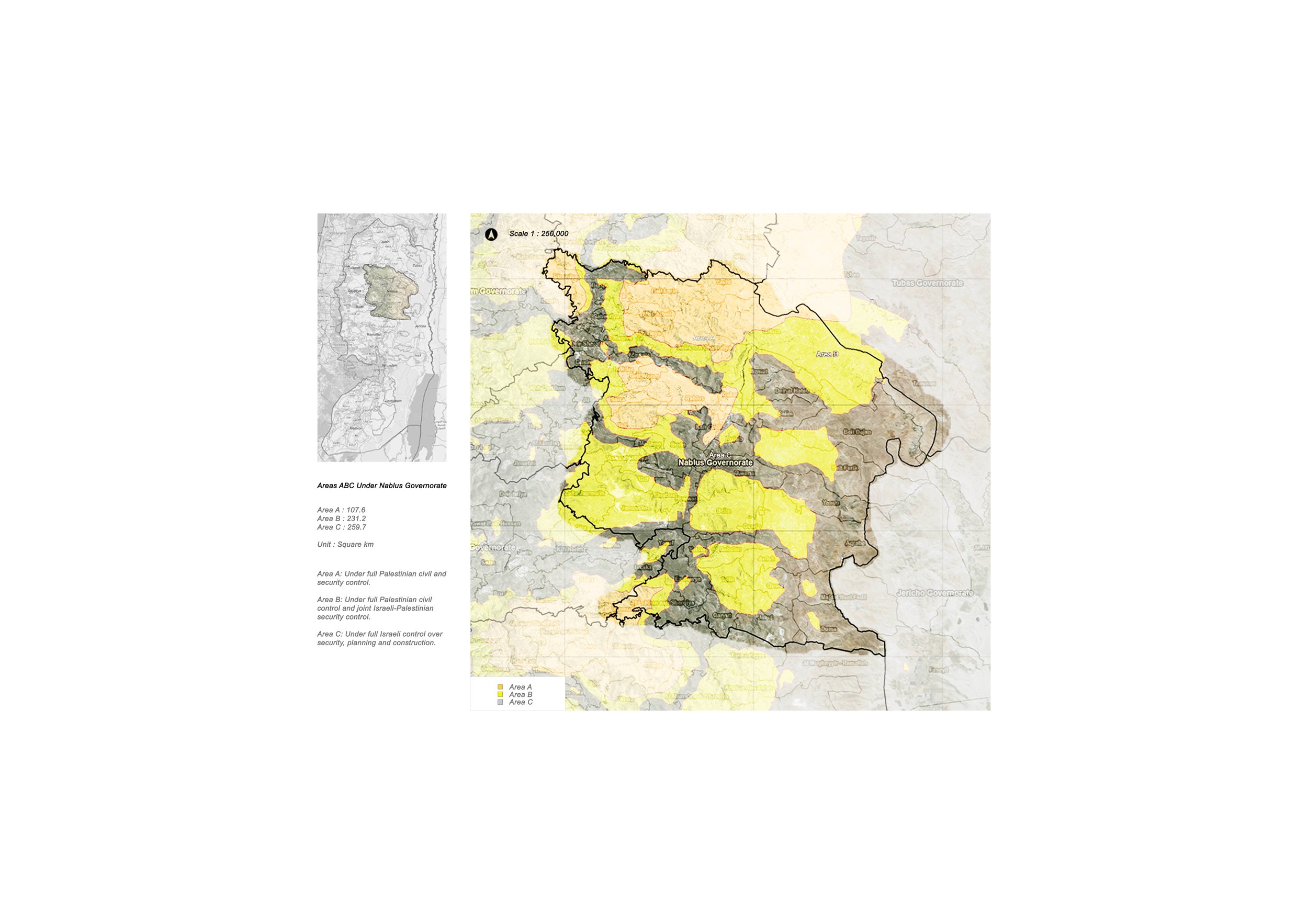
The following diagrams show the Jurisdiction borders under Nablus Governorate, Area A B C and total number of demolished structures.
The occupied West Bank was divided into three areas – A, B and C – as part of the Oslo Accords, signed by the Palestine Liberation Organization (PLO) and Israel in 1993 and 1995.

Finding a tool is helpful for developing a methodology, using bulldozer as a tool to link between demolish acts and conflicts.

Meso
Zoom into meso view, case study of conflict and demolish acts
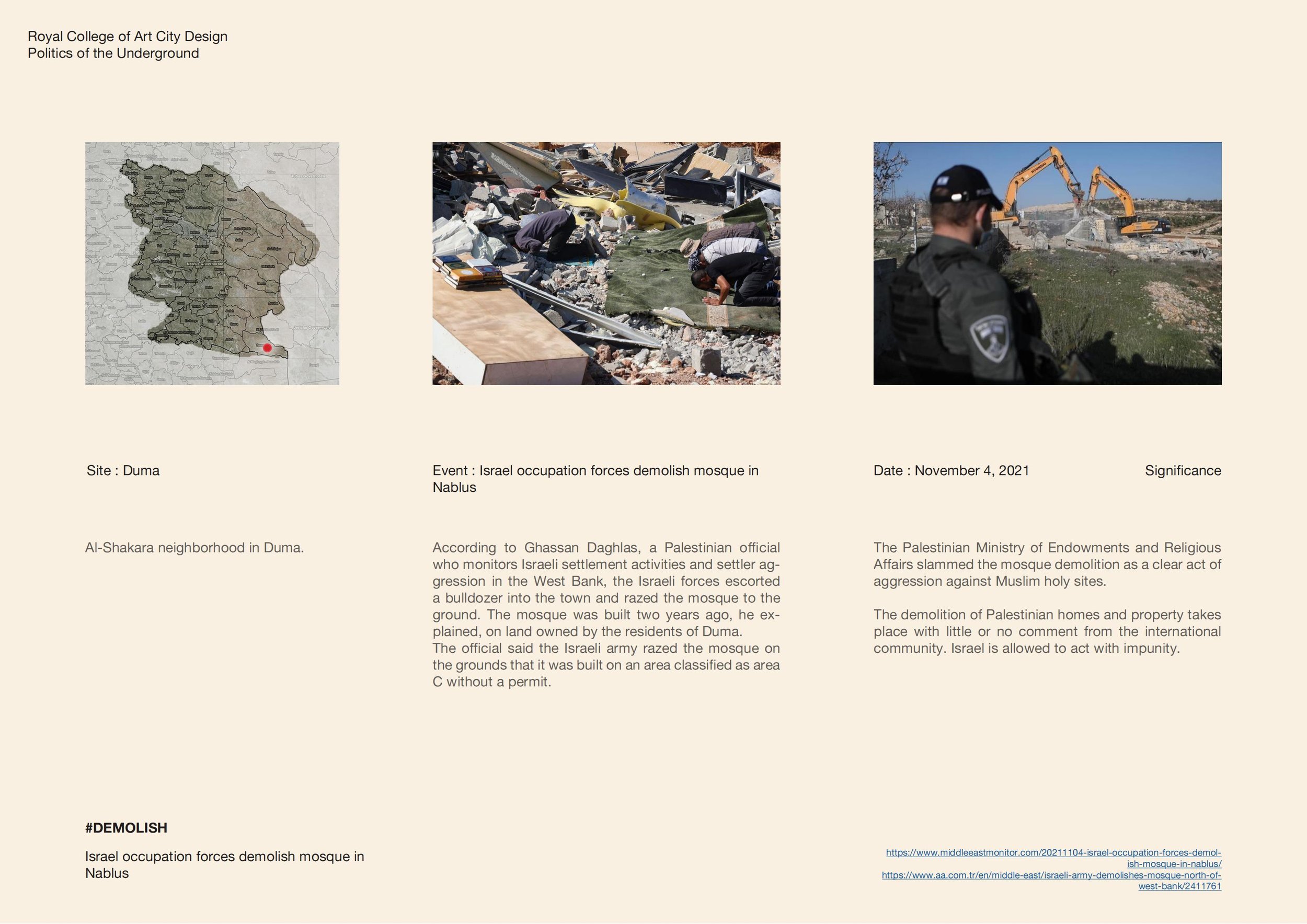
A series of demolish acts conducted within Nablus territory


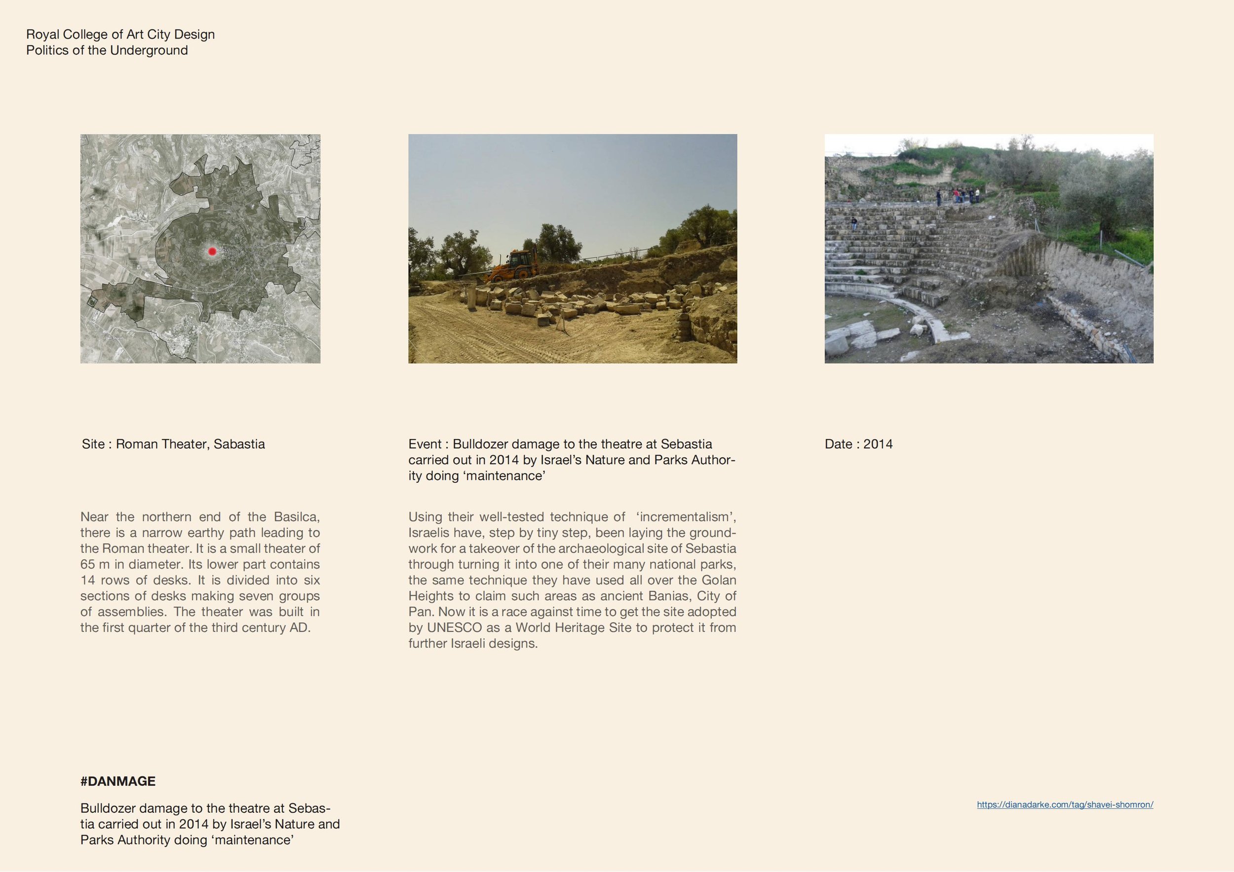
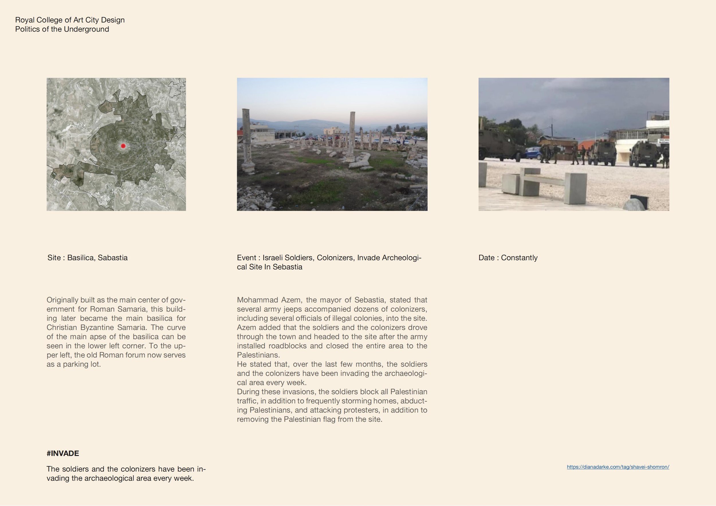
A series of demolish acts conducted within Sebastia territory


Narrative evidence
Based on previous slides, made a video which is part of the research inventory to be seen as narrative evidence. I’ve chosen an area which centred around the Basilica, this particular area selected involves cultural heritage, archaeological remain, tension and conflict. Which makes it quite a typical representation of the whole region.
George Santayana once quoted “To know your future you must know your past” and I think this also applies. From 1999 to present the cultural landscape has transformed from almost a fuzzy area to a quite genuine public plaza. By comparing and observing this cultural landscape over the past 2 decades and thinking about the political atmosphere of the Israeli-Palestinian conflict gives a better understanding of the relationship between cultural, archaeological and social context.
Next step for me will be to continue on meso scope and reach out to more cases and try find inner connections also from each case dig deeper and explore their cultural, archaeological and social context. And develop to micro gradually from cases to individual study or interviews.