Yiru Qian
My research consists of 3 parts - the Masudiya station, the Gush Emunim zionist movement, and the effects brought by the establishment of Israeli settlements - taking Shavei Shomron as a case study. The research begins with the general history and current context of the Masudiya station. Thousands of Gush Emunim supporters marched four decades ago demanding that the government establish settlements in what they call after its biblical name: Samaria. The site of occupation, where the movement initially took place, the station has become one of the prominent symbols of Zionist settlements. From here, settlements began to expand in the region. The case of Shavei Shomron - the nearest settlement to Sabasitya looks at how the land grabs to establish the settlement and its current presence affect the surrounding Palestinian villages.
RAILWAY AND STATION
history, abandoned, remains
![ Hedjaz Railway Map [1914-1919]](https://images.squarespace-cdn.com/content/v1/6193d8efe3cb1036220b12e4/1638910480208-BII6EXAW06WIOXYSOQZW/Railway+Map+1914-1919.jpg)
![Vintage postcard, Bahnhof Mesudije mit Herodesberg [Estimate 1915]](https://images.squarespace-cdn.com/content/v1/6193d8efe3cb1036220b12e4/1638910528087-3MCPAO24FI0CD3IQT28N/Bahnhof+Mesudije+mit+Herodesberg+%28vintage+postcard%29.jpg)
![The collection of maps named after Eran Laor, the National Library [1942]](https://images.squarespace-cdn.com/content/v1/6193d8efe3cb1036220b12e4/1638910506449-E3BFQD8DK2GG5CFT5NIW/Railway+Map+1942+Original+marked.jpg)
The collection of maps named after Eran Laor, the National Library [1942]
Hejaz Railway Map [1914-1919]
Vintage postcard, Bahnhof Mesudije mit Herodesberg [Estimate 1915]
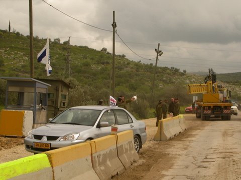
Sabastiya was served by two stations on the Hejaz railway: Masudiya station and Sabastiya station (no record). The Hejaz was used to establish a connection between important cities such as today’s Istanbul, Mecca, Jerusalem, Cairo, Damascus, etc. Work on this railway began in 1900, during the reign of the Ottoman Sultan Abdul Hamid II (1876 - 1909), and was opened after 8 years. Parts of the railway were destroyed in 1916 during the First World War (1914 - 1918).


The main building of Masudiya station, photos taken at 1975, 2016, 2021 The auxiliary building of the station, photos taken at 2013, 2016
Masudiya station was initially intended for both, access for pilgrims, and for Palestinian residents of the villages to move to neighbouring cities quickly. There are 2 buildings in this specific station, the main station and an auxiliary building servicing the station with its cistern. The station no longer functions, and has since been used for multiple purposes. Palestinian residents of Sebastiya frequent their station seeking calm and nature in a site that bears an important part of their country’s history. Some of the residents remember hearing stories about the time the train used to run in their fields.

The deputy head of the Burqa Municipal Council, north of Nablus, Jihad Sherida, said about it: "It is a land with an area of about 26 dunums (one dunam equals a thousand square meters), donated by the residents for the benefit of the Hijaz Railway, during the time of the Ottoman Empire, and it is now owned by the Palestinian state. After it was private property. Israeli resource claimed the Station property is now owned by the Israeli state.”
While inspecting some stone buildings among old trees, Sherida continued the story, saying: "We have been trying for several years to turn this site into a family park, but the Israeli measures prevent this, especially since the site is divided into two parts, one in Area B, and the other in Area C, according to the Second Oslo Agreement.” - Resource from here
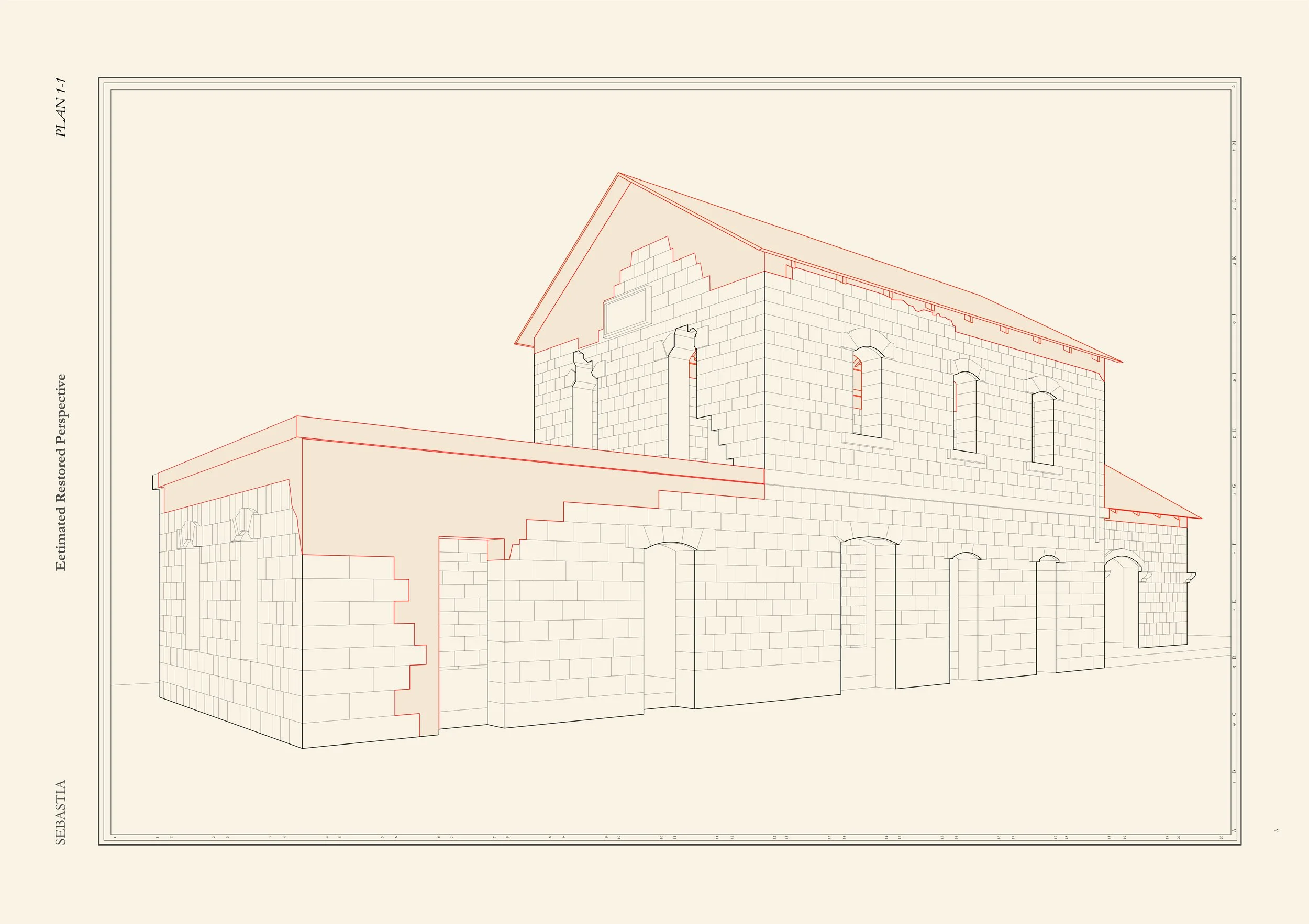
Master plan for Masudiya Railway Station. The dash line in the master plan shows the location of the original railway, which is demolished and paved by a road now. The black block indicated the station. The scope of property is shown in dark grey solid line, where occupation happened from past until now. - Drawn by Yiru
“What distinguishes this site is its presence in a beautiful agricultural area that is relatively far from the noise and daily life, which takes you to nature and its charm. I always visit the site, and I enjoy this place with My friends.”
Memories with the Hejaz Railway
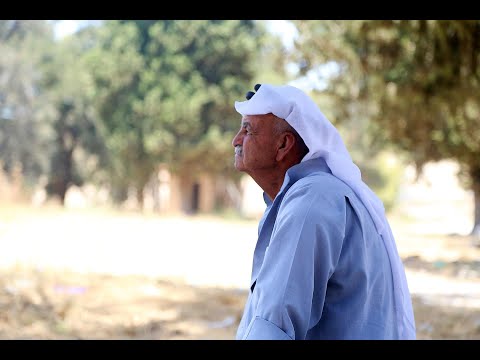
Ahed Abd al-Salam Daghlas witnessed important stages in the life of the Hejaz Railway. A child grabbed the oranges of the workers on the train while passing through the Masoudiya area northwest of Nablus. He grew up playing on the railway tracks. He also witnessed the impact of the wars and occupation on the railways and its success. Douglas, who is nearly eighty years old, still remembers the trip that his father promised him to their shop in the village of Balad Al-Sheikh, Haifa district, on the train, but the political events that followed that deprived him of the trip forever. Work began on the Hejaz Railway in 1900 AD and it was opened in 1908 AD. The line started from Damascus, and branched from Bosra in southern Syria into two lines, one of which reached the south towards Jordan, and the other headed west towards Palestine. Nablus, Haifa and Acre were the most important stations of the line in Palestine.
Interview Translation :
This area used to be a central hub for the villagers around the area. The train used to come through the area when we were kids we were afriad of the train! The area around the train line was agriculture and our moms used to plant the fields and harvest the fields. The workers of the train lines we knew very well they were from the villages around here. They actually used to throw us sacks of food from the trains as it passed and throw it from the moving train to the villagers to eat. Every time the train came from Jaffa and Haifa and moved up to Amman and Nablus. Passengers used to wait at the station to go to Amman in one direction and Jaffa, Haifa, Nablus, Jenin. It was a very normal part of our life. We used to harvest the fields with the sheep and watch the trains go by. In 1967 we still had farms here. We spent our youth here around Faqoos (Palestinian cucumber) Watermelon etc. In 1967 the Jordanian arm took the area and fenced it in and used it as a strategic location for the 6 day war and when we lost the war the Jordanians left it. When I was a kid there used to be a little shop in a nearby village called Al Shaikh (Balad al shaikh means the village of al shaikh). My uncles and father used to work there and my dream was to go with them one time but because I was too young I didn’t go. We lost that area in the war and Till this day I haven’t managed to visit this place. All of that area that was lost in the war I have never seen.
GUSH EMUNIM OCCUPATION MOVEMENT
gush emunim, occupation, sabastiya agreement
Gush Emunim (Block of faithful) is a religious-messianic right-wing group, which is founded to promote the Jewish settlement of the 1967 occupied territories and seeking a return to the « promised land» related to Israeli history.
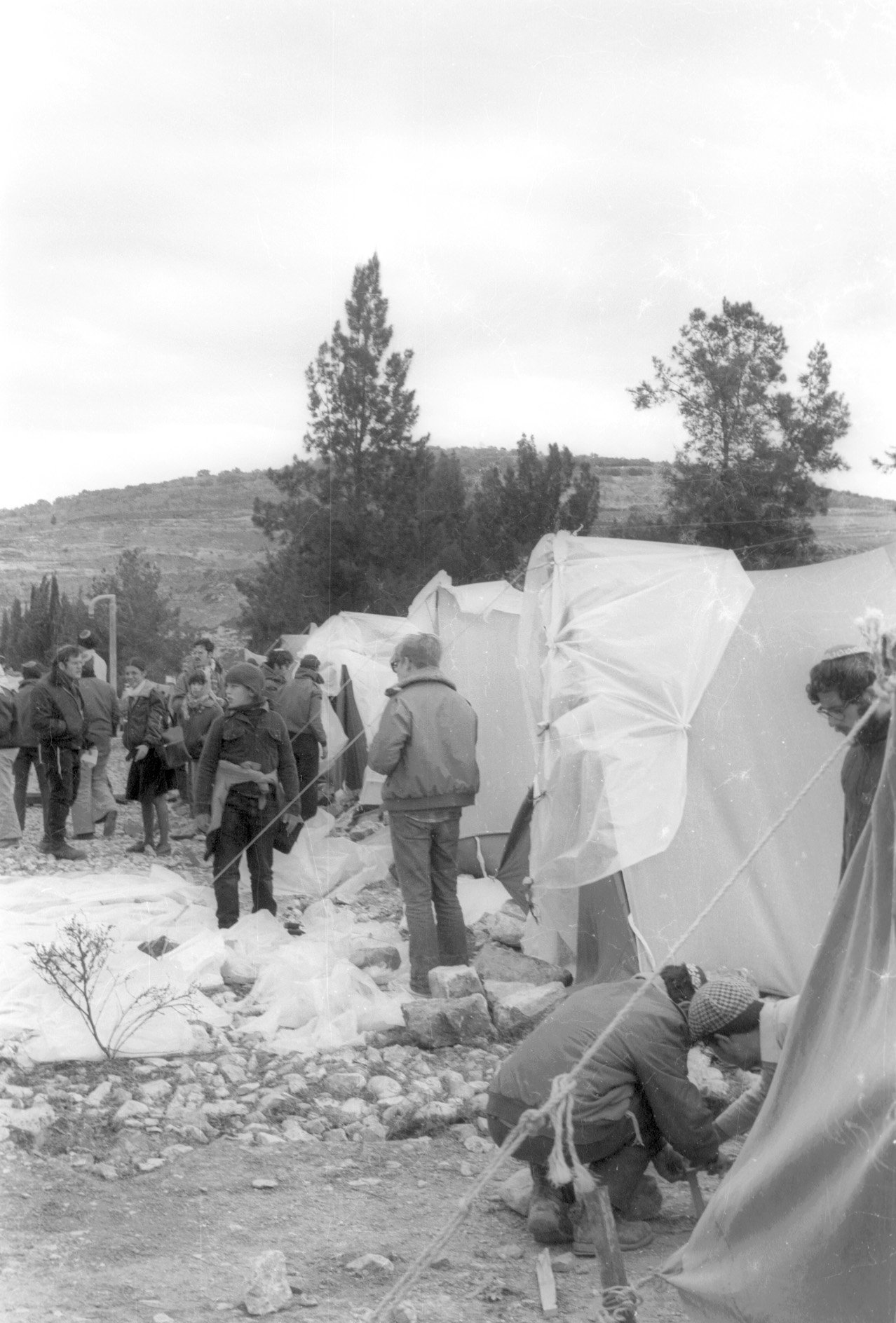
Shortly after the end of 1973 war, a group of young women, led by Daniella Weiss, who later become secretary-general of Gush Emunim, met with Prime Minister Golda Meir. They come to ask for government permission and assistance in establishing a small settlement in Masudiya station. The location is recommended by Ariel Sharon, who just left military service to begin political career. The site was well outside the borders of Allon plan, which sought to colonize mainly the Jordan Valley and the areas around Jerusalem. Meir politely declined the request. Her refusal led to eight consecutive attempts to in the following 3 years settle the location without permission.
The ‹ascents› is named for settlement-establishing expeditions, which is led by a group of would-be settlers who comprised the settlement-core of Elon Moreh. The members of the Elon Moreh core and other national-religious groups joined together to form Gush Emunim.
-Text summarised from <Hollow land>, Eyal Weizman, Chapter 3. Settlements: battle for the hilltops and wikipedia
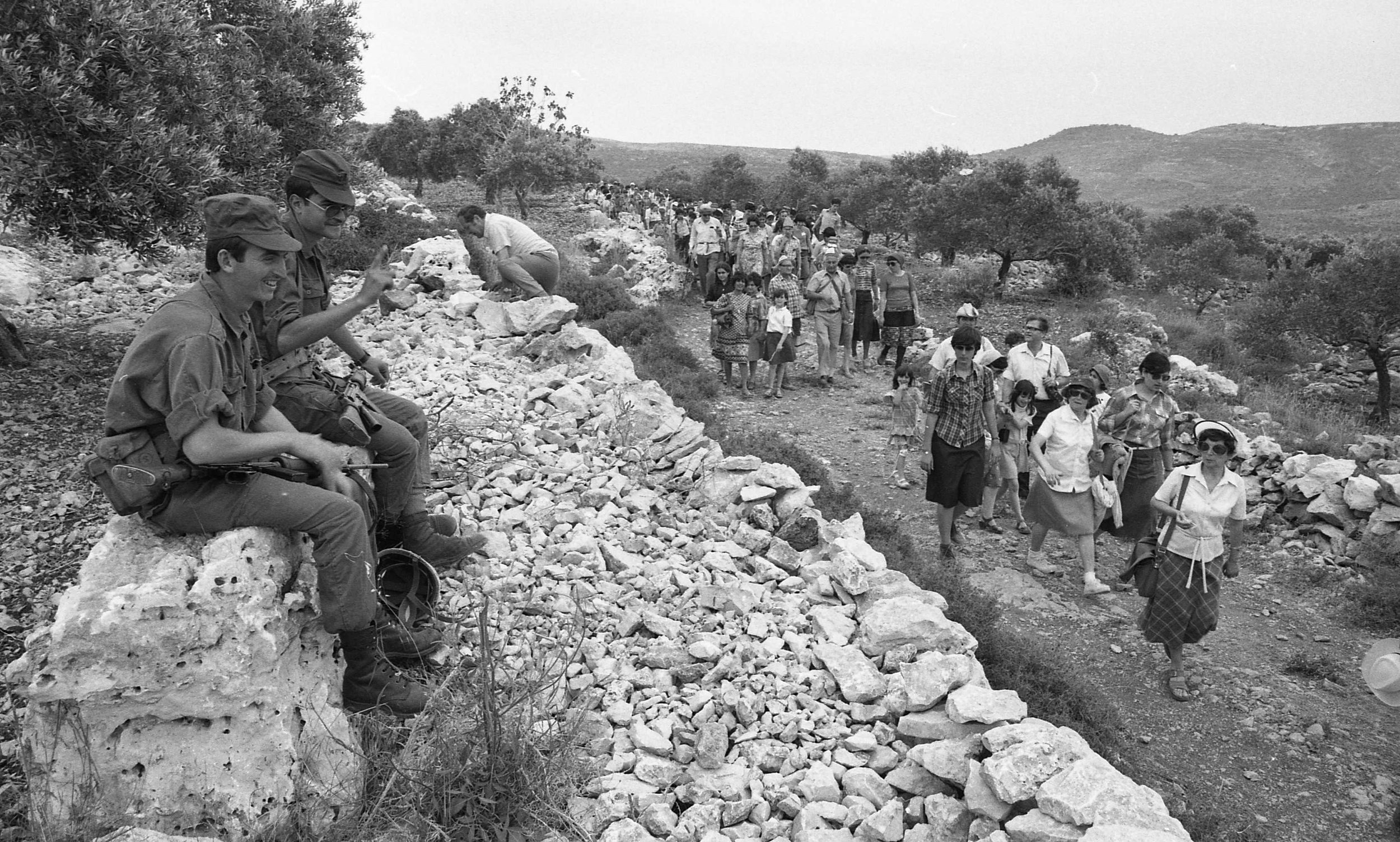
Gush Emunim_Acsension to Sabastiya, National Library of Israel [12 August,1975]
Occupier near Masudiya station, National Library of Israel [1978]
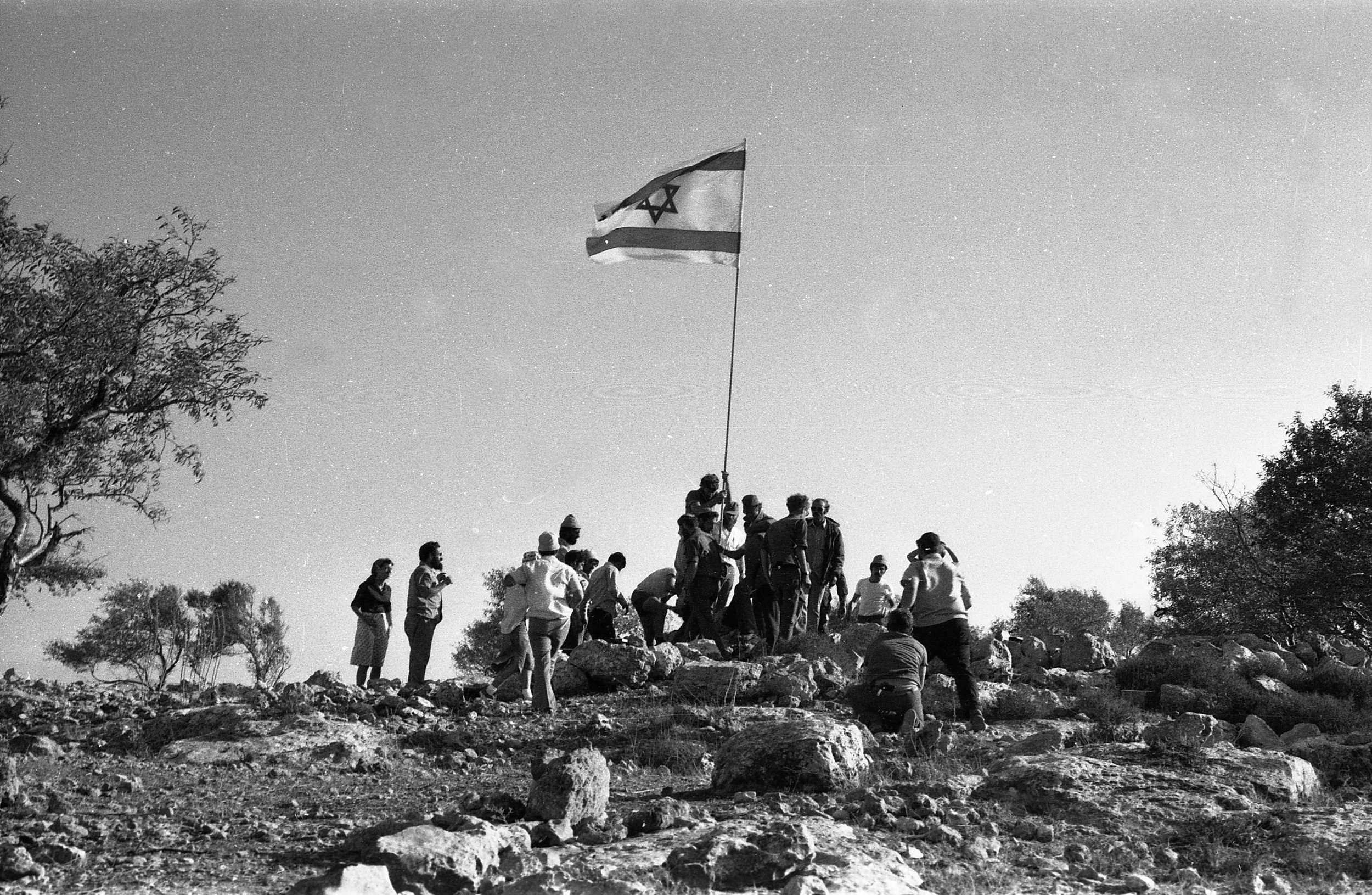
Gush Emunim flag on hilltop1978, National Library of Israel [1978]
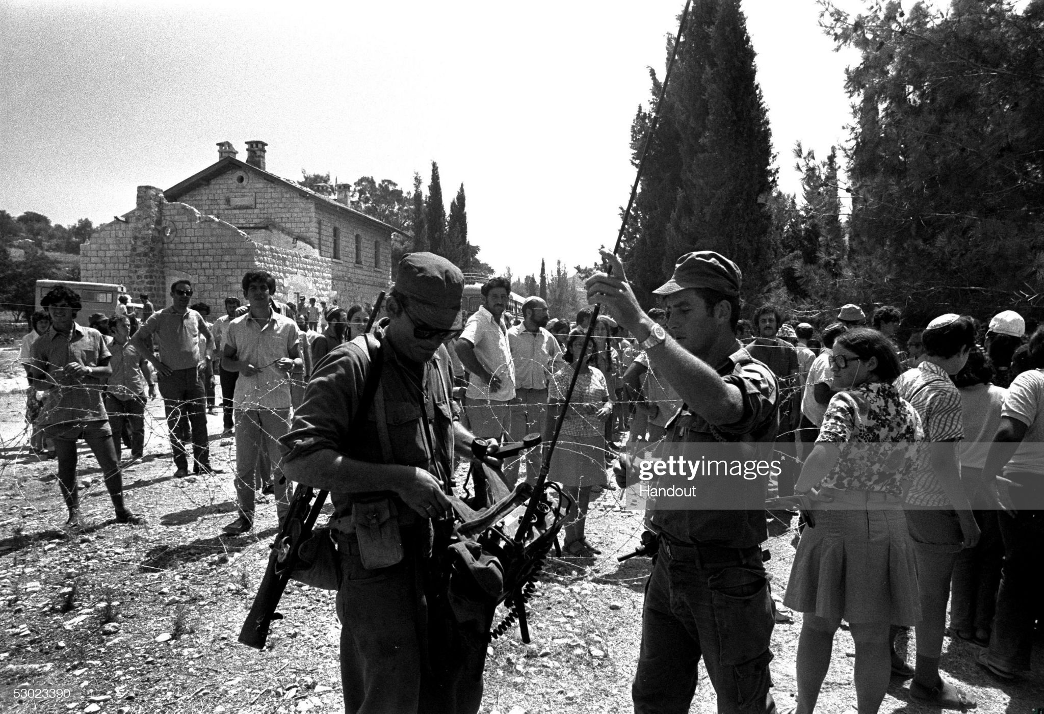
Hulton Archive [24 July,1974]

Hulton Archive [24 July,1974]

Hulton Archive [24 July,1974]
1975 occupation mapping
According to Gush Emunim occupation movement photo archive of Hulton Archive, 8th Dec 1975, a second increase, the drawing mapped how settlers shown in photo positioned. Solid red circle represents settlers at a concrete position, hollow circle represents settler’s estimated position, rectangle stands for vehicle and the tilled rectangle presents tents. The drawing only showed information from specific photos, it means settlers participate the occupation are far more than 50, actually from record, the population was estimated as several hundreds, Israeli resource shows there were thousands.-Drawn by Yiru
2015 occupation mapping

The occupation did not stop with the 1976 agreement. To this day, these activities continue uninterrupted. The occupation movement mapping is done based on a video which was uploaded on 2015.12.14. - Drawn by Yiru
Resource: Here


In winter of 1976, after another ascent, during the holiday of Hanukkah, after another ascent, a compromise was reached between the settlers and government in the main hall of sabastiya railway station. The Sabastiya agreement was a turning point that opened up the northern West Bank to Jewish settlement. The Sabastiya model was subsequently copied in Beit El, Shavei Shomron, and other settlements.
Sabastiya mode somehow shows a pattern that military base was appointed by Israeli government to be their temporary staying. As the enclave is getting bigger and bigger, permanent settlement would be agreed by government in the end. This story happened to Qedumim and Elon More too. This drawing shows how occupiers are relocated to different locations. Grey shade represents settlement, while darker grey shade represents military base. - Drawing drawn by Yiru
“Settlements are the single most important element shaping life in the West Bank. Their destructive impact on the human rights of Palestinians far exceeds the hundreds of thousands of dunams seized to build them. ”
For more general knowledge about settlement, please click here.
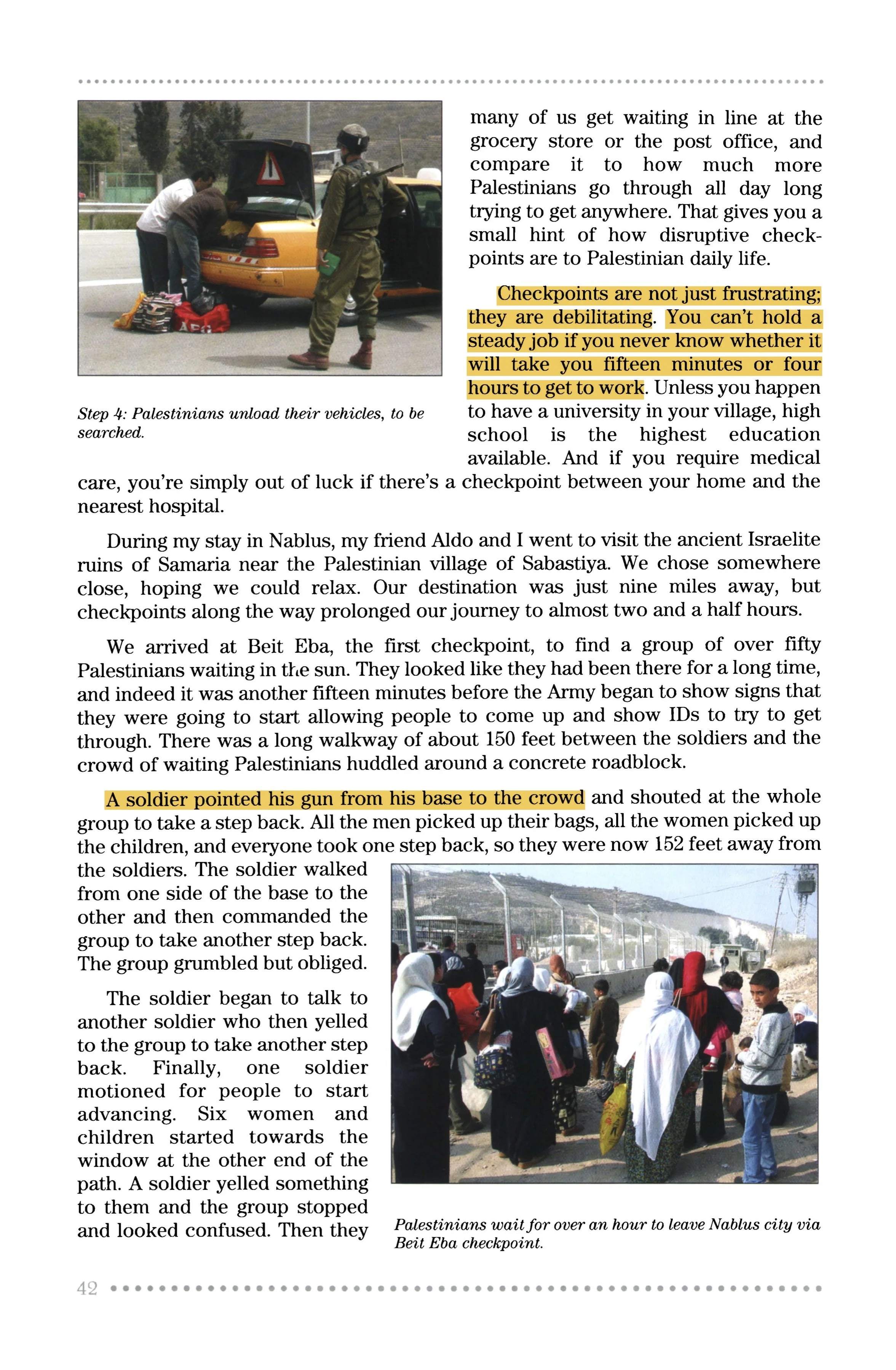
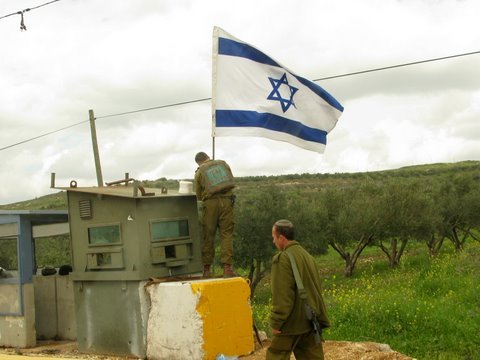
SHAVEI SHOMRON SETTLEMENT
expansion, dumping site, checkpoint
Shavei shomron, not only as one of the settlements near sabastiya, but also as one of the sites where relocated settlers who were during the early Masudiya station occupation activities, has also been developed as an object of interest in this study.
Shavei Shomron (Hebrew: שָׁבֵי שׁוֹמְרוֹן, lit. Returnees of Samaria). After the occupation of 1967, Israeli occupation forces overtook the base and transformed it to a military post. According to ARIJ, Israel confiscated land from two nearby Palestinian villages in order to construct Shavei Shomron: 680 dunums of land were taken from An-Naqura, while 236 dunums were taken from Deir Sharaf.


Left: A group of house in Shavei Shomron settlement, 2017 Right: A group of Palestinian house near station, 2009

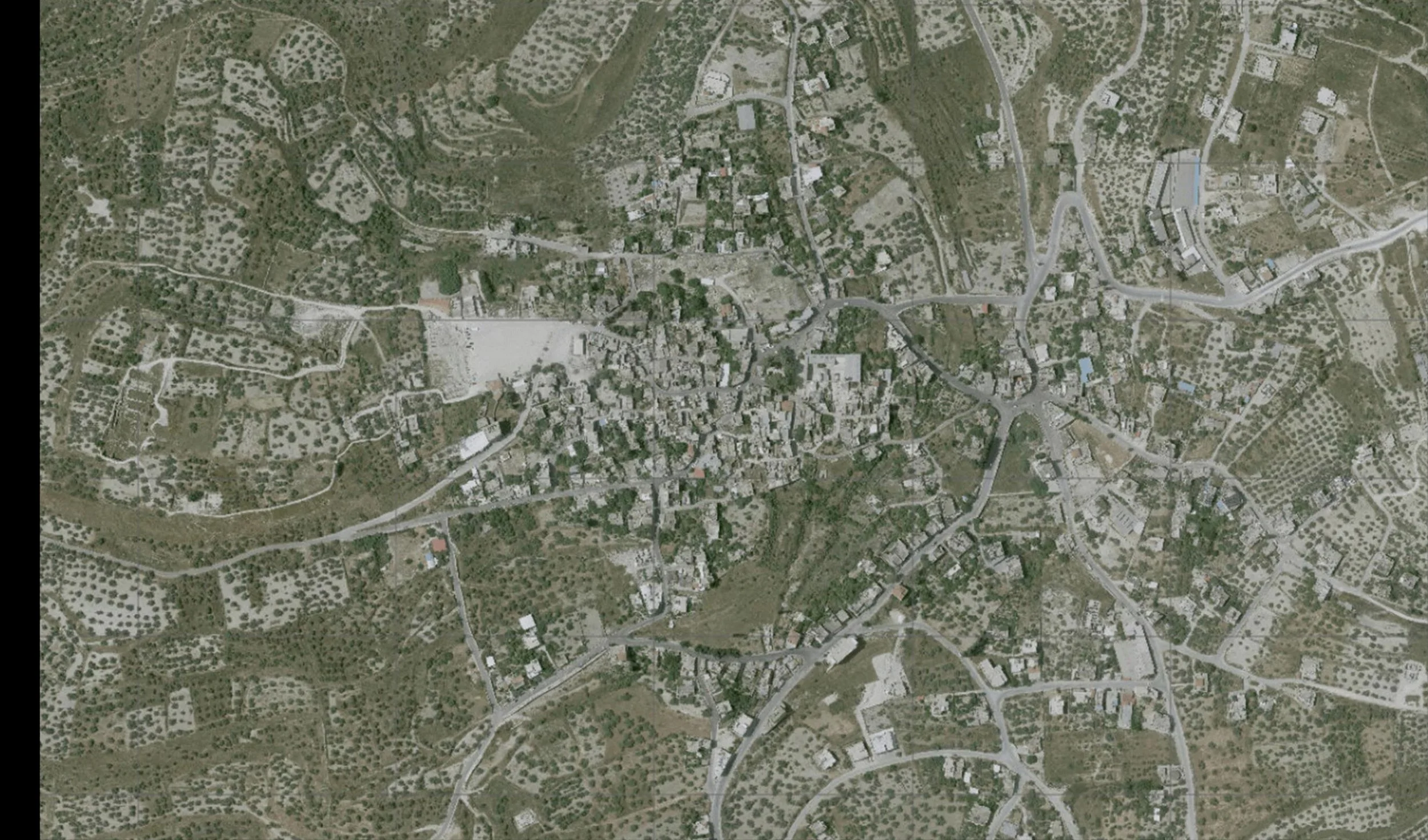
Left: Satellite map of Shavei Shomron,2019 Right: Satellite map of partial Sabastiya, 2019
Michael Boneh, an Israeli architect made a guide book entitled <Building and Development in the Mountain Regions>. The suburban layout of a mountain settlement typically follows a principle of "concentric organization”, in which the topographical contours of map are retraced as lines of infrastructure. The roads are laid out in rings of following the shape of the mountain to create complete circuit around the summit, with the water, sewage, electricity and telephone lines buried under them. -Resource <Hollow land> Eyal Weizman, Chapter 4. Settlements: Optical urbanism
-Expansion
Currently, the colony has expanded to include 2000 dunum. There are 631 colonists living here. In 2005, Israeli occupation forces erected a fence surrounding the colony which led to the confiscation of hundreds of agricultural dunums beneath and beyond the fence. During the past a few years, the settlement has been expanded over year and year.

Shavei shomron Satellite image 1999

Shavei shomron Satellite image 2000

Shavei shomron Satellite image 2006

Shavei shomron Satellite image 2009

Shavei shomron Satellite image 2014

Shavei shomron Satellite image 2019
The overlap of the outlines from different years indicates the expansion of this settlement. According to my research, these expansions were mainly from the three surrounding Palestinian villages. At least 680 dunums land is taken from An-Naqura and 236 dunums land from Dier Sharaf. - drawn by Yiru
Updates:
Here is the Settlement & Annexation Report: January 22, 2021, which indicated 152 new units expansion are promised.
-Dumping site
Besides land confiscation brought by expansion, dumping site is one of the other negative affects settlement would brought to surrounding villages.
Sebastia’s residents say raw sewage from the settlement flowing onto their fields is causing substantial damage to crops as well as their apricot and olive trees. In addition to threatening the town’s agriculture and environment, the wastewater (which flows from a pipe around the settlement and creates puddles leading down to the fields) will also eventually affect tourism to the archeological sites. But this contamination isn’t the only challenge facing this historical town.
Read more: https://www.al-monitor.com/originals/2013/03/ancient-sebastia-threatened-israeli-settlement.html#ixzz7Dq39m0Dc
Area map shows the dump point, checkpoints nearby- Drawn by Yiru